Hiking Mauritius: Le Morne Brabant & Le Pouce Guide
For many, Mauritius is primarily a tropical paradise with turquoise water and long sandy beaches. However, the island has much more to offer. If you enjoy hiking, you can discover an impressive variety of landscapes here. The mix of lush rainforest, rocky ridges, and wide plains could hardly be more diverse. In addition to relaxed paths, there are also challenging routes. These reward you with breathtaking views. Among the most popular tours are the hike up Le Morne with a view of the underwater waterfall and the route through lush greenery up Le Pouce. If you already have some experience and are fit enough, in our opinion, you can save money on a guide and easily explore the mountains on your own. Also, if you’re looking for more adventures beyond hiking, feel free to check out our Mauritius Travel Guide. We’ve gathered many more tips for you there.
Le Morne Brabant
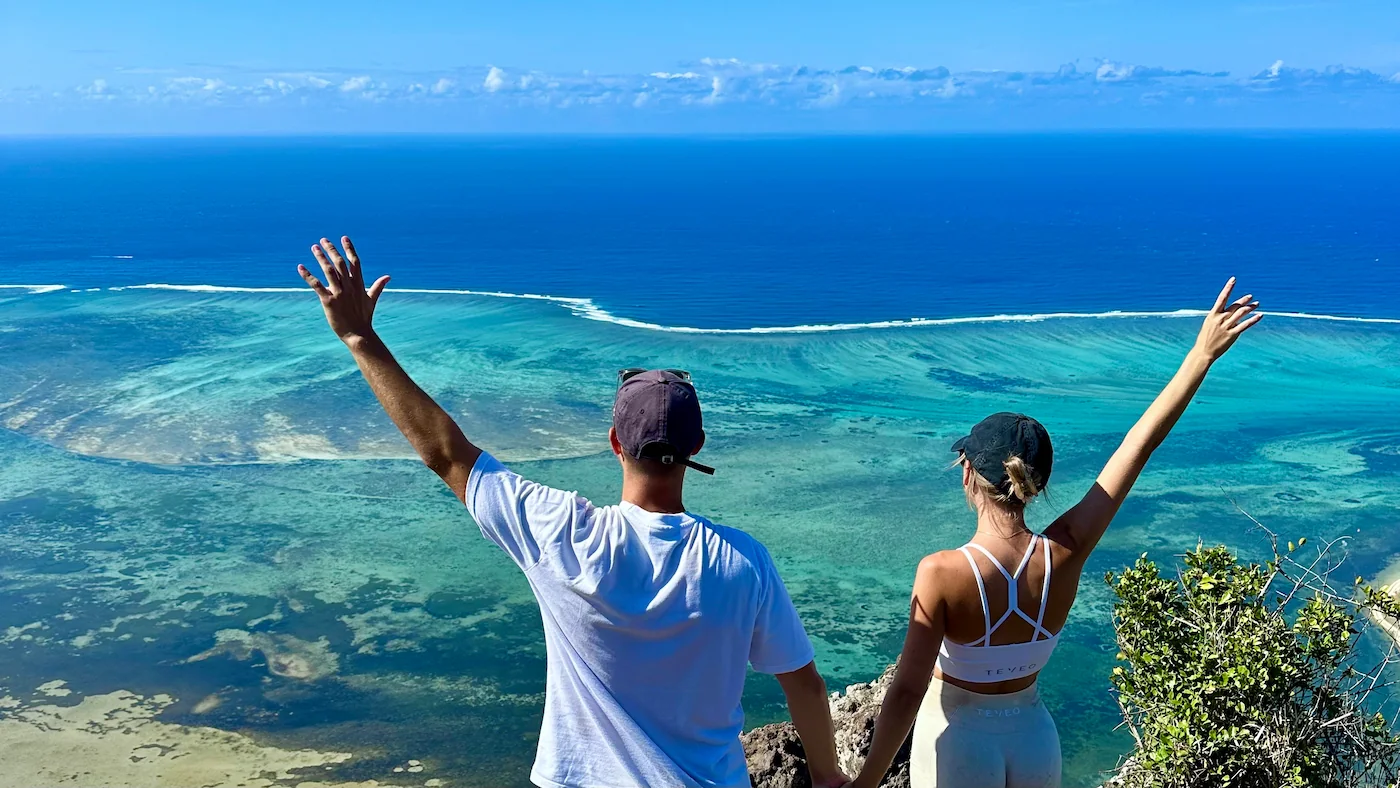
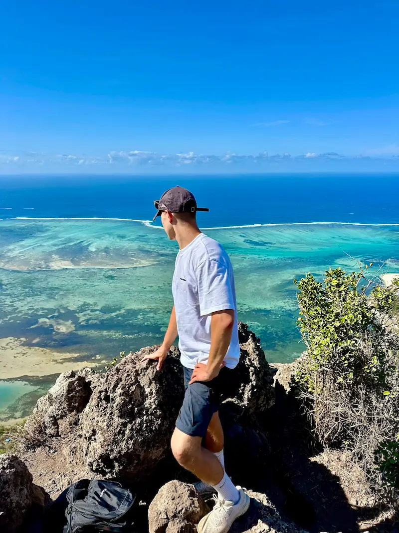
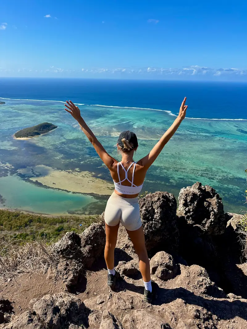
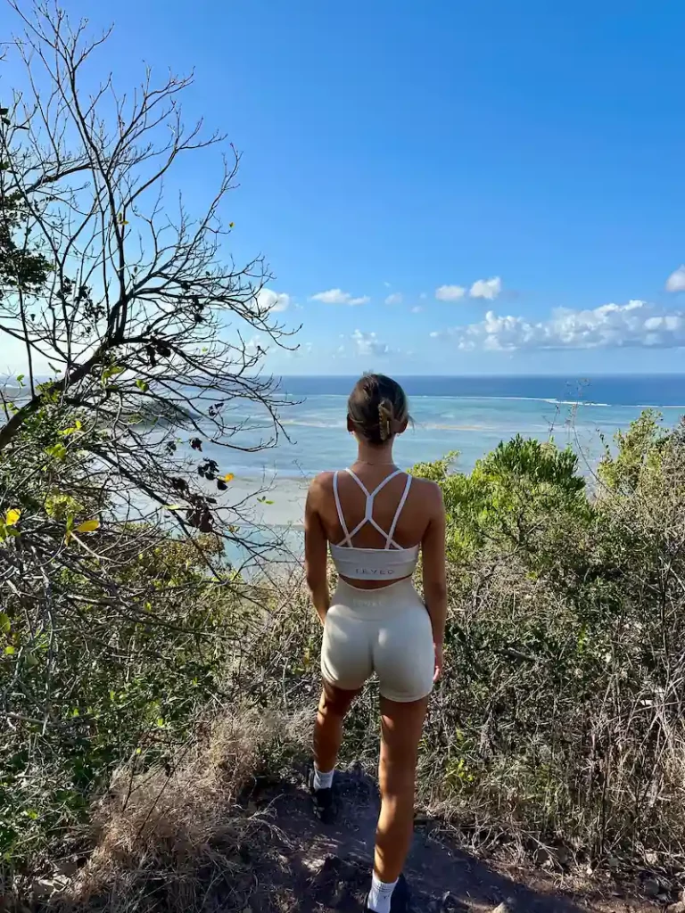
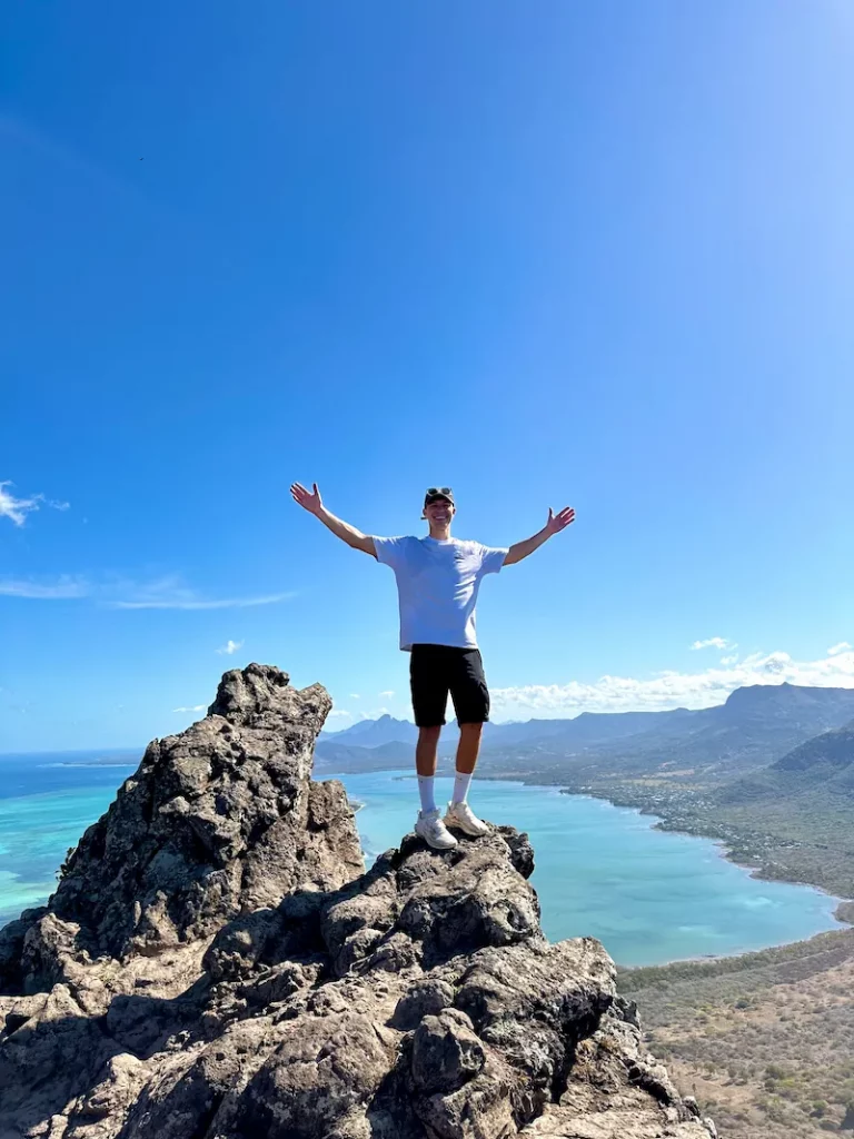
The hike up Le Morne is one of the most impressive experiences on Mauritius. In fact, it was one of the best hikes we have ever done. Even from afar, the striking rocky mountain towers over the landscape. It acts like a natural observation tower over the southwest of the island. The path leads you through tropical vegetation and over some steep rocky sections. It constantly offers breathtaking views of the lagoons and the surrounding coast. This is definitely an experience you won’t forget anytime soon.
Hiking Le Morne
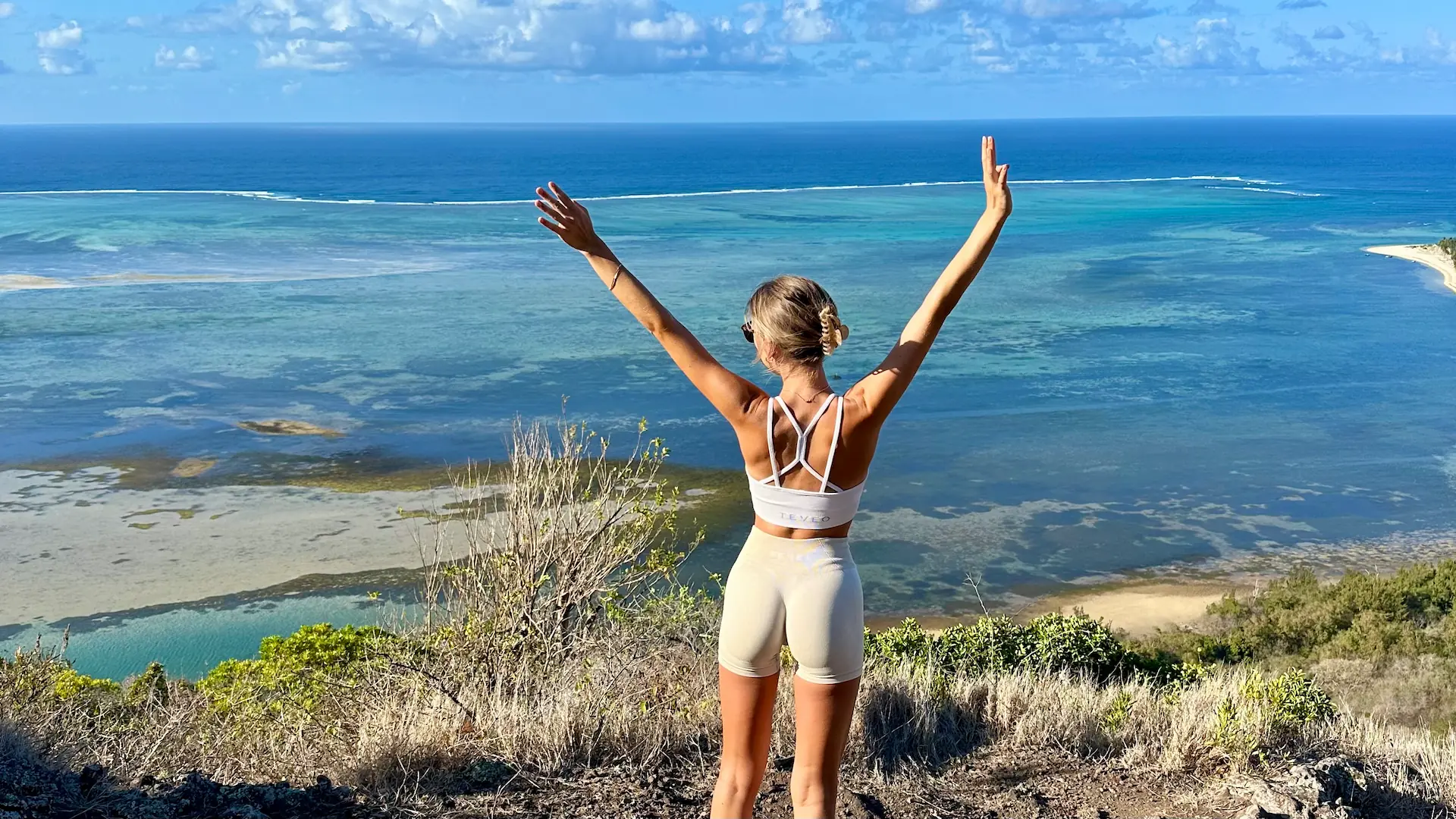
The hike begins with a wide gravel path that leads slowly into the mountain. It gradually becomes narrower and narrower. After the first few meters of elevation and some beautiful viewpoints, the most difficult part begins halfway through. From here on, the ascent becomes significantly steeper. It requires both fitness as well as climbing skills and a head for heights. In some parts, it goes almost vertically up the cliff, so you have to repeatedly use your hands for support and to pull yourself up. It is a total of 492 meters in altitude to the summit cross. Depending on your pace and the crowd, you will need about 1.5 to 2 hours. Once at the top, there is a small natural platform with a unique view of the underwater waterfall and the entire island.
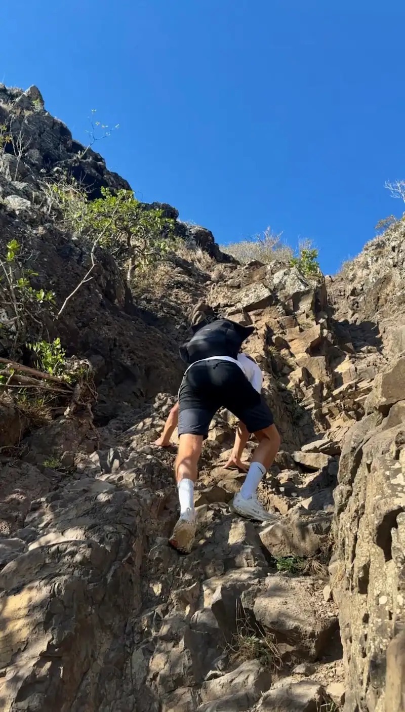
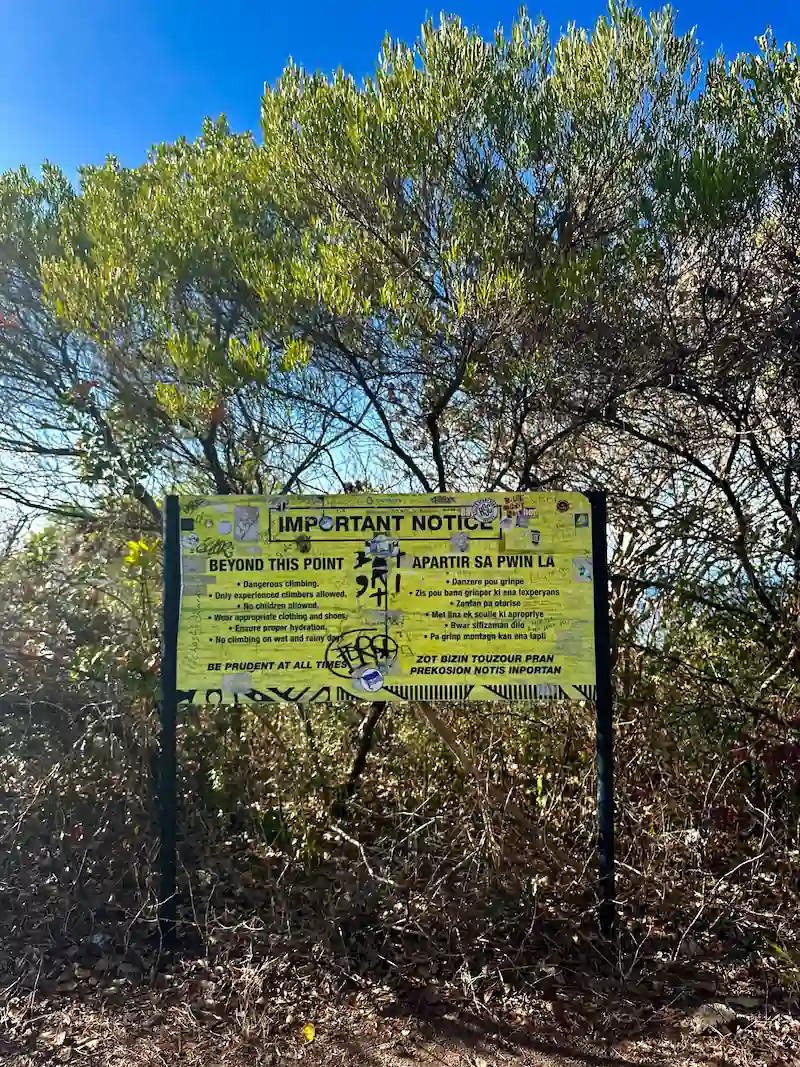
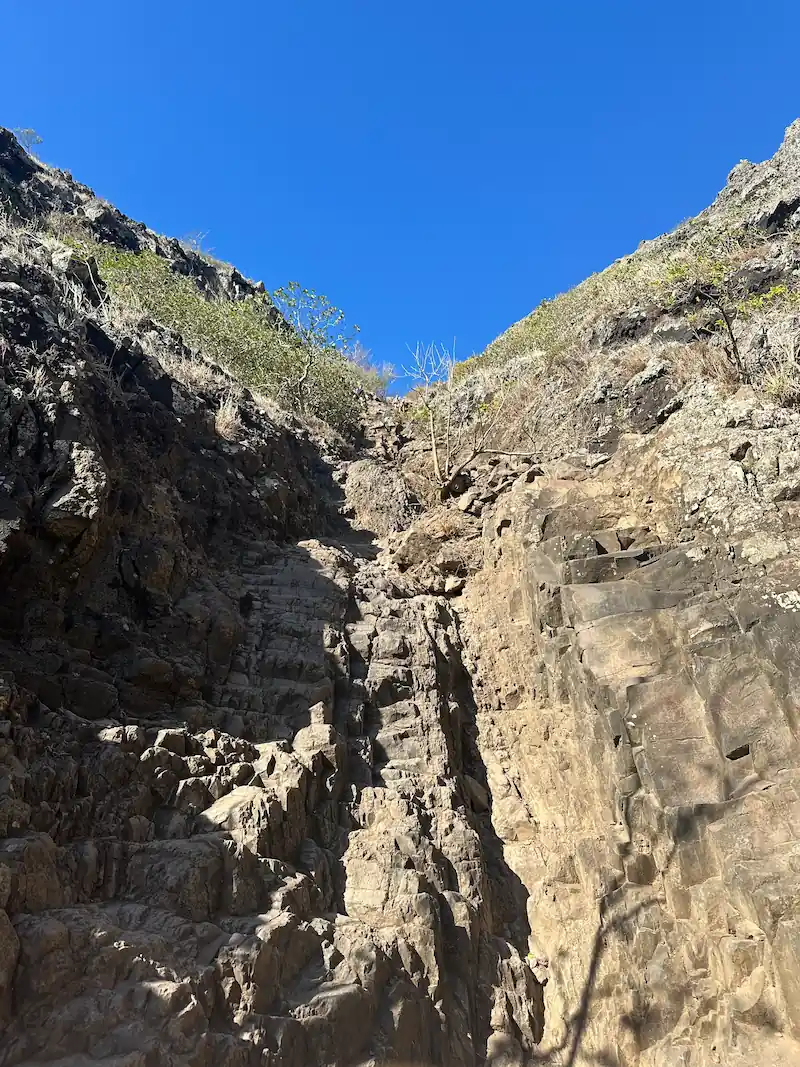
Since it can get very hot on Mauritius in the morning, you should start the hike as early as possible. It is best to start around 5 or 6 am. From the halfway point onwards, there is no more shade. You are completely exposed to the sun there. This leads to the rocks heating up more and more. Leaning on them with your hands can become quite uncomfortable. Additionally, it gets increasingly crowded over time. This makes it more dangerous, as there are many bottlenecks where you often have to wait for oncoming traffic. Good shoes are an absolute must. Also, remember to bring enough water, sun protection, and a few snacks. It is best to also pack a hat. Make sure your backpack is not too heavy. This way, you have both hands free while climbing.
Do I need a guide?
Guided tours are offered here, as in almost everywhere on Mauritius. Online and on-site, we found offers for about 35 to 65 Euro per person. On the way up, we repeatedly saw people who abandoned the ascent. For them, having a guide by their side would have made perfect sense. However, if you already have hiking experience and good fitness, the hike is feasible without a guide. For this, you should also be able to keep your cool near the abyss. The main thing is that you are honest with yourself and do not overestimate your abilities. Therefore, we have selected a few guided tours for you here.
Starting Point & Parking
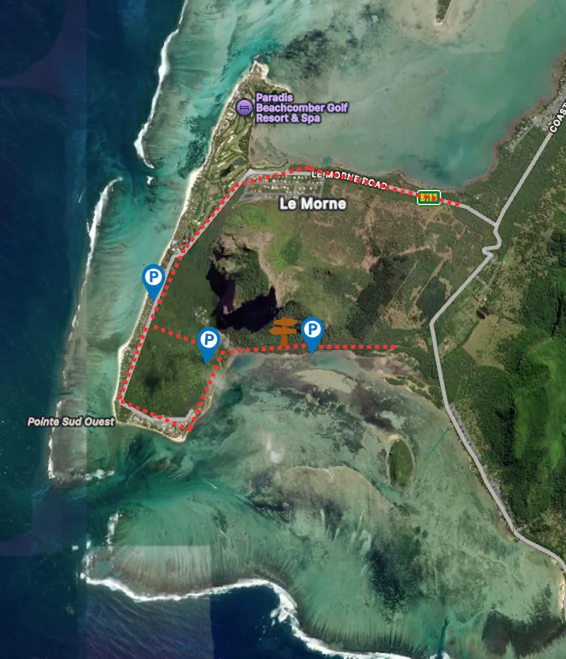
The official access to Le Morne Brabant is located at the southern end of the mountain. It is reachable via a short gravel track that branches off the main road. Access is free of charge and open daily from 7:00 am to 4:00 pm. You just need to register briefly at the gate. If you start the hike earlier, for example at sunrise, you might find the gate locked. However, this is not a major obstacle. In the immediate vicinity, there are small beaten paths leading around the gate. From there, simply follow the signs to easily reach the official trail.
You can park either at Le Morne Beach, at Le Morne Kitesurfing Beach, or right next to the entrance at the western foot of the mountain. The parking lot at the entrance is naturally the closest. Therefore, it fills up the fastest. We chose to park our car at Le Morne Kitesurfing Beach instead. From there, it is about 500 meters to the entrance. You reach both parking lots by turning left onto the narrow gravel track from the coastal road, about 400 meters before Lux Le Morne. Then, follow the road for another kilometer.
Le Pouce
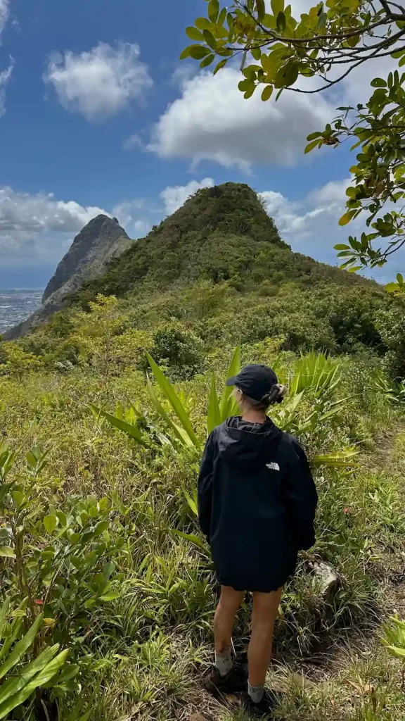
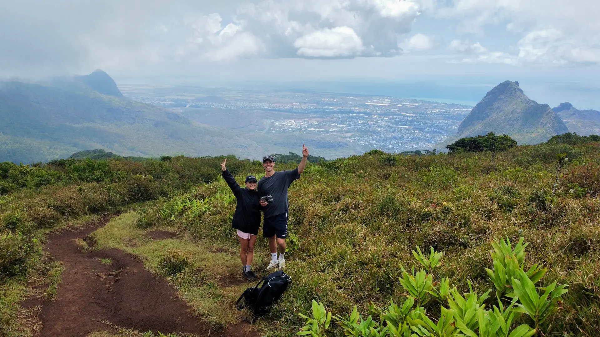
Le Pouce is the third highest mountain on Mauritius. It is one of the island’s most famous hikes. It owes its name to its striking shape, which resembles a thumb. This makes it unmistakable even from afar. The mountain is located near the capital, Port Louis. It offers an impressive 360 degree view over large parts of the island. Depending on which side you approach from, the ascent can be more leisurely or more challenging. Once at the top, an impressive panorama awaits you. You can see Port Louis, the Moka Valley, and the sugar cane fields. On a clear day, the view extends far beyond the coastlines.
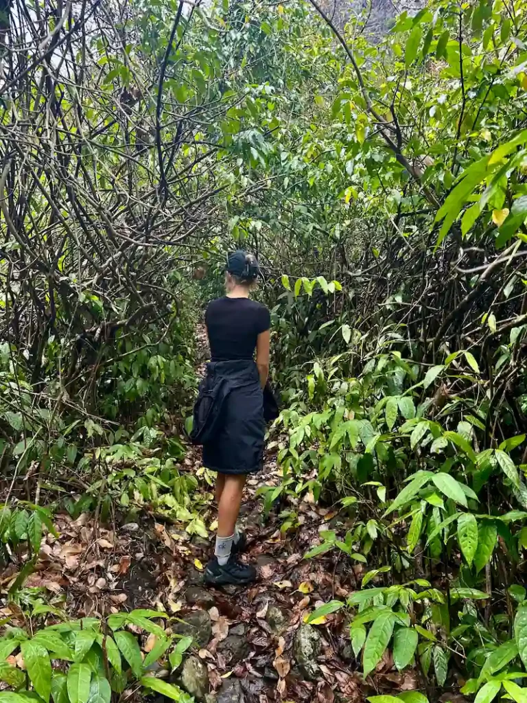
Hiking Le Pouce
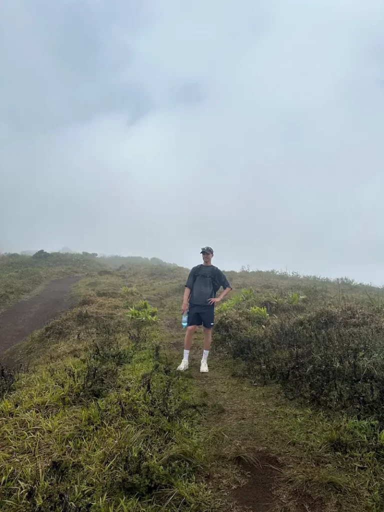
There are actually two ways up Le Pouce: a short and easy route via the southeast and a slightly longer, challenging route from the north. We chose the 12-kilometer north route. It took us about 6 hours for the round trip. We caught a bad day weather-wise, so everything was wet and foggy. However, that made the hike quite special for that very reason.
The northern route is varied and scenically beautiful. It starts on wider paths that become narrower and more densely overgrown until you can hardly see the sky. The closer you get to the summit, the steeper the climb becomes. In the final meters, a few small climbing passages are even necessary. The north route requires fitness and sure-footedness. However, it rewards you with spectacular views and few tourists.
The shortest and most popular route to the summit starts in the southeast in Moka Saint Pierre. It is about 2.1 kilometers long. The round trip takes approximately 2.5 hours. Both paths are marked with blue and white markings on rocks and trees, which you simply need to follow. No matter which route you choose, you should definitely remember to bring enough water and snacks. Also, keep in mind that the weather on the mountain can change quickly. The paths become very slippery when wet.
Trail Head & Parking
There are two starting points in the north from which you can begin the hike. The much nicer option starts at the end of Chateau D’Eau St. Here, you will find a small outdoor fitness park where you can park your car. The path is initially paved before leading into the greenery after a few hundred meters. The second starting point is at the end of Pouce St. However, this path initially leads through a kind of wasteland and is not quite as scenic. After about 2 kilometers, both paths merge into one trail.
The Southeast Route, on the other hand, starts in Moka (Saint Pierre). It is the relaxed alternative via wide paths. This version is perfect for anyone looking for a less strenuous tour.

